Riverland levee checks after River Murray flow update
The state government says a new forecast predicts that up to 120 gigalitres a day will stream down the River Murray into South Australia by early December – the highest flow since 1975 – with engineers and flood planners heading to the Riverland to check levees.

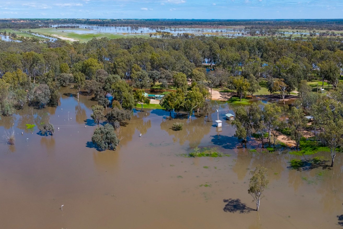
The River Murray is already flooding part of Loxton Riverfront Holiday Park. Photo: Murray River Pix
Revealing the escalation at a press conference this afternoon, Premier Peter Malinauskas urged the Riverland community and visitors to be prepared but not alarmed.
He said a team of engineers and flood planners would make their way to Renmark tomorrow to assess two council-owned levees of concern.
“Today the Government has been in receipt of updated advice telling us that up to 120 gigalitres of water per day will start to flow down through the Riverland starting in early December,” Malinauskas said.
“That is a revision upwards to the extent of 30 gigalitres a day which is a rather substantial amount indeed.
“We want to be prepared without raising unnecessary alarm.”
Yesterday, InDaily reported that floodwaters -then estimated at 90 gigalitres a day – threatened to close some key Riverland roads, a bridge and ferry services
Malinauskas said the new information “doesn’t suggest that major towns are set to be inundated with major flood events”.
“But nonetheless we are advised that South Australia does face the prospect of more water coming down the River Murray than what we have seen since 1975,” he said.
Malinauskas warned the expected 120 gigalitres could be revised upwards again in the future with more rain forecast.
“The good news is that levees in and around the Riverland particularly in Renmark are designed to be able to accommodate up to 130 gigalitres a day,” he said.
“The culmination of a substantial upgrade today in the forecast of a lot more gigalitres coming down the river along with the prospect of future rain events does mean that we need to start getting ready. Luckily a degree of time is on our side.”
Malinauskas said “there are a couple of parts of the levee system which does raise a degree of concern and they are parts of the levee system that up until this point have been the responsibility of the local council”.
“So what we are now doing is working to provide the full assistance available of the State Government to assist those council levees to assess their preparedness and any works that may need to be done to them,” he said.
Malinauskas said that tomorrow a team of State Government engineers and flood planners, along with the SES, would assess the areas “that may be a little vulnerable”.
“That is an act of prudence – we’re not doing that because we are seeking to cause any unnecessary alarm but simply to demonstrate a degree of preparedness that we believe is necessary at this particular time,” he said.
“So levee systems will potentially be tested and we do need to be getting prepared where we can.”
Malinauskas said the Government was still “actively encouraging people” to visit the Riverland and “support those local communities” – “it’s just important that that is done with an additional degree of caution particularly if you are using the river itself”.
“Making sure you’re wearing a life jacket, making sure the boat is kitted out with the appropriate equipment – these little things can make a difference,” he said.
Environment and Water Minister Susan Close said the department was taking the forecasting and modelling “very seriously” and expected to provide weekly updates.
While the current forecast is for 120 gigalitres, Close said: “If there is more water that falls, more rain that falls in the coming week and weeks in Victoria that will very likely mean an increase in the water coming through to South Australia in early December.”
Close said that would not mean the water would come any sooner “but it will mean it will be higher and we know that they’re forcasting more rain already so we need to be ready for that 120 gigalitres to be escalated”.
She said people living in the Riverland area could find more detailed projections specific to them on the Environment and Water Department’s website “so that they can prepare on the ground”.
Close said the two levees of concern – the Hospital Bank and Hale St Bank levees at Renmark – would be “fine even if they aren’t working fully, for 130 and 150 gigalitres, but nonetheless we are starting to get up to that level where we would need to be assured that the levee will be able to hold”.
Emergency Services Minister Joe Szakacs said: “Whilst this is not an emergency, I want to give the residents in the Riverland an absolute assurance that our SES supported by our emergency services are well prepared to support our community.”
He said the SES had had an incident management team based in the Riverland since July.
“The SES have been dedicating significant resources and hours to preparing for this extreme flow of water – they are ready for this flow,” he said.
SES chief officer Chris Beattie said “the good news from the community’s perspective is that at that level (120 gigalitres) the townships themselves aren’t threatened”.
“But (they) will continue to see the continuation of minor impacts on the shack communities in low lying areas, on some of the infrastructure in low lying areas such as low lying gravel roads, the effluent treatment plants that are managed by the councils…” he said.
“The levees themselves will start doing their job at about 130 gigalitres a day so at this stage we are not forecasting that the levees will be topped.
“The levees themselves will protect the townships up for well above 130 gigalitres. That’s where they start doing their job though and that’s where we will be having to monitor and patrol.”


