Flood evacuation warning for Murray Bridge
Residents of low-lying areas in Murray Bridge and Tailem Bend are the latest to be warned to prepare to evacuate due to the “high risk” of River Murray flooding.


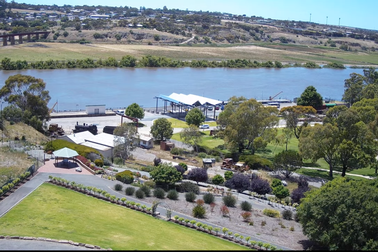
The live flow cam of Murray Bridge today. Photo: Rural City of Murray Bridge
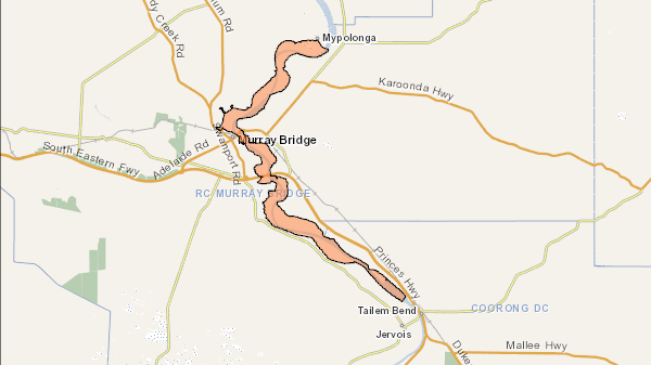
The SES at 11.30am on Friday issued a flood watch and act message for Mypolonga, Murray Bridge, Swanport and Tailem Bend, warning residents they should prepare to find alternative accommodation.

The latest flood watch and act area issued by the SES.
“There is a high risk of flooding for low lying areas between Mypolonga to Tailem Bend, including Murray Bridge due to rapid river level rises that may threaten your safety,” the SES said.
“Regardless of your property’s ability to withstand flood impacts there is a chance you may become flooded or isolated.
“If you remain in the area you may become trapped without water, power and other essential services.
“You should now prepare to evacuate. If the situation worsens it may not be safe to leave. It may be too dangerous for emergency services to assist you.”
It comes after the SES on Thursday told residents further upstream at Younghusband, Mannum, Caloote and Pompoota to prepare to evacuate.
A watch-and-act message is also in place for a 40-kilometre stretch of the river further upstream, taking in Caurnamont, Purnong and Bowhill.
The flooding threat from the swollen River Murray is gradually moving downstream from the Riverland, with authorities predicting the flood peak will hit Berri between December 25 and January 5, Waikerie between January 1-12, Swan Reach between January 5-16 and Murray Bridge between January 6-17.
The peak flow predictions remain between 190 and 220-gigalitres a day, predicted to hit Renmark between December 24-31.
Around 4000 properties across the state are expected to be inundated with water when the flood peaks.
The Rural City of Murray Bridge has set up a live “flow cam” to monitor the fluctuating river levels and its impacts on the town’s riverfront.


